|
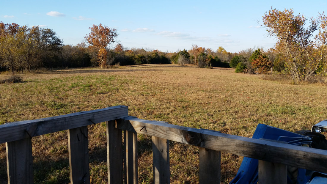
No matter the State or the season, when traversing public lands for hunting, fishing, camping or hiking be sure to use accurate resources. While evaluating public land hunting options I was scrolling across my go-to map system for viewing cities streets, checking aerial views of land, and verifying directions to a destination. But I found that this search engine's mapping system was clearly inadequate to display public land. This is not a minor inconvenience, hunting any game even in season on private land (that you did not receive permission for) can lead you to fines if not jail time depending on your State's laws and the mood of your local game wardens. Recently apps like onX Hunt have recently provided the outdoorsman quick access to respectfully accurate information on land ownership. But these apps tend to come with a price tag while most of the information provided is free, maybe just not as convenient. Being familiar with your State's wildlife (or natural resource) department's website is a must. Proceeded second by knowing your local game warden. Below I show a couple examples of where an online search engine's map displays less than half or no information of public lands, while the wildlife department's resources are clear cut. And any additional questions can then be answered by your local game warden. Also, check out our State Trapping Resource page, as it includes the wildlife or nature resource department website for each State here in the U.S.
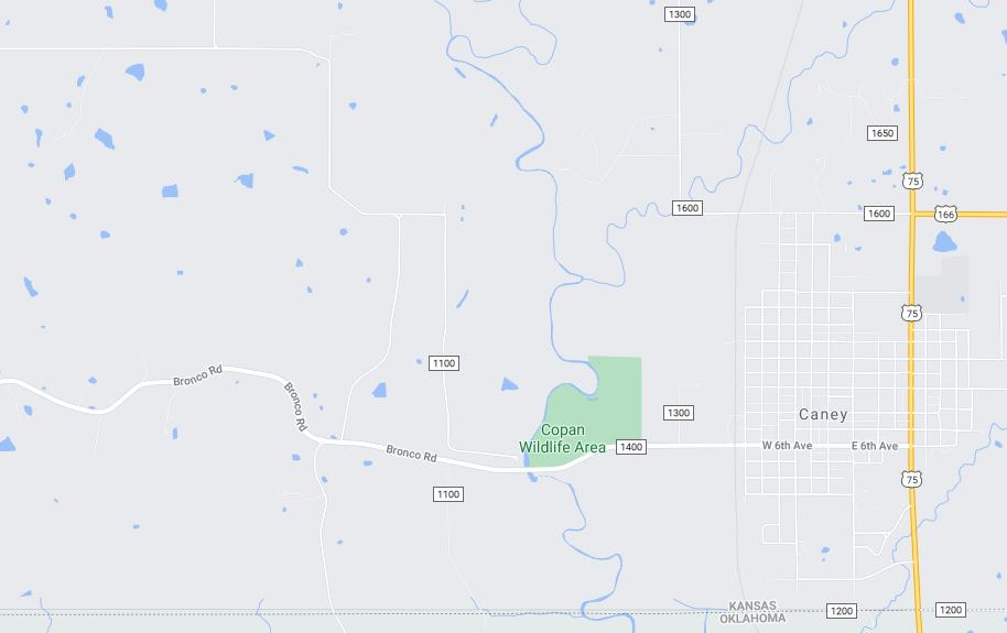
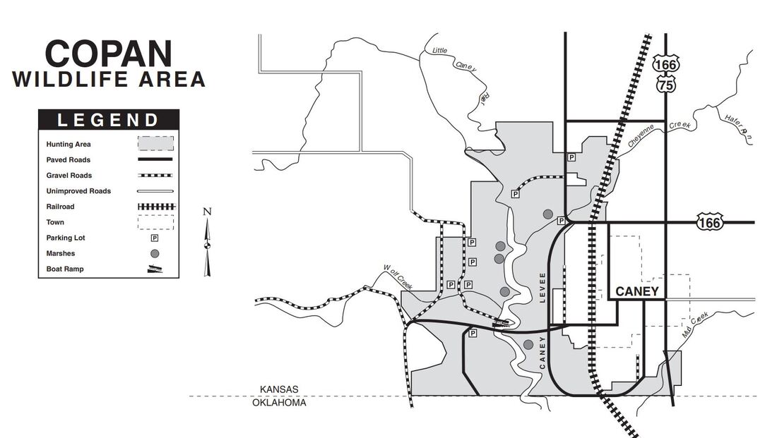
The Copan Wildlife Area in Kansas sits just west of Caney. From the online map (LEFT) shows barely a portion of the actual area designated for public use. The Kansas Wildlife Department's website https://ksoutdoors.com/ has webpages for each wildlife area, with information like maps, PDFs, news and more. Their image (RIGHT) shows the actual wildlife area for legal hunting and public use.
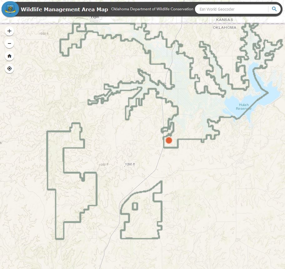
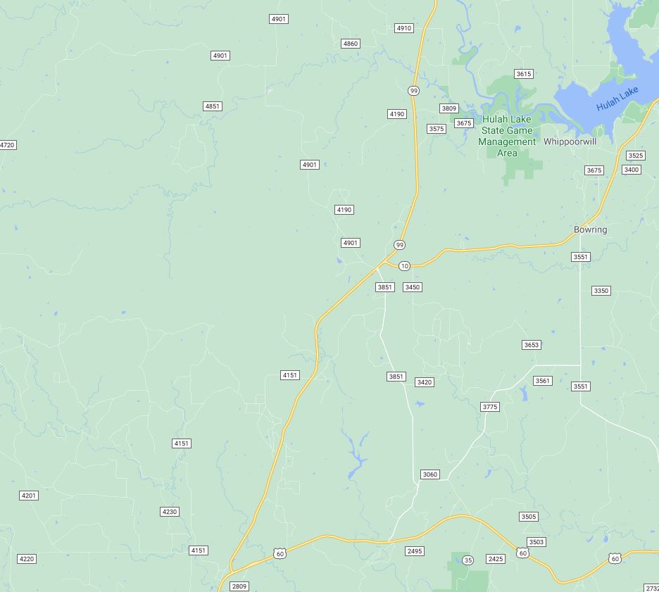
The Hulah Lake public lands are clearly seen on the Oklahoma Dep. of Wildlife Conservation's map site (https://odwc.maps.com/) (LEFT). Including further south the Western Wall and Rock Creek wildlife management areas. And seen there (RIGHT) the search engine's map shows less than half of the public lands around Hulah lake and does not show either the Western Wall or Rock Creek.
0 Comments
|
Article Source
These posts link to people like you, sharing their experiences and opinions. Credit is provided in each post. If you would like to share content message me under Contact. Archives
November 2020
CategoriesAdvertise your site here. Include an image below to reference your service or products.
|